What I did
- Code:
React.js, Mapbox, D3 - Database:
PostgreSQL
Project Goals
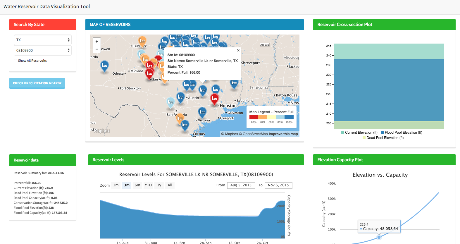
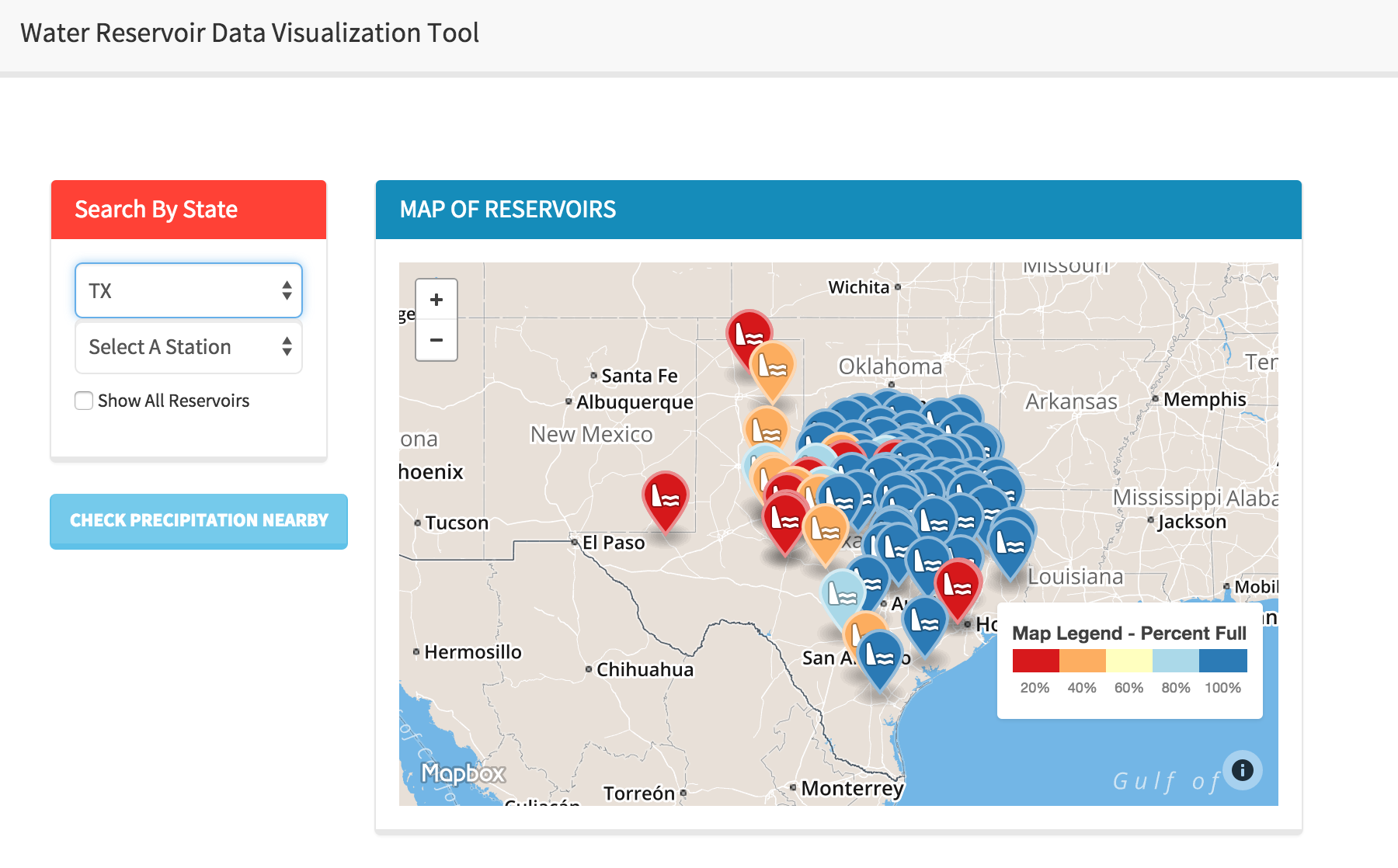
The Water Reservoir Data Visualization Tool (WRDVT) identified location-specific water reservoirs across the southern United States. WRDVT provided instantaneous updates regarding reservoir elevation levels, dead-pools, conservation pool elevation levels, reservoir’s physical status, reservoir levels over time, elevation-area-capacity curves for each reservoir and precipitation data. WRDVT centralized multi-state water reservoir data in one robust, web-based platform. The development of this tool also received this review, as quoted in the proposed Presidential budget: “Such collaborative efforts have already supported a water reservoir visualization tool for water managers... in [the] Southern US.”
Methods and Approaches
Reservoir data was extracted from the Texas Water Development Board, U.S. Geological Survey and the U.S. Army Corps of Engineers, which detailed the current water elevation, elevation-area-capacity interpolation, and the reservoir’s physical status. Software was developed using Postgres, JavaScript, and Python (Tornado) to assist with the visual representation of WRDVT.
Results
WRDVT was successful in identifying location-specific water reservoirs across the southern United States. Specific information regarding the past and current status of each reservoir is accessible and successfully acts as an information provider to multiple agencies.